
RTK GPS technology enhances standard GPS accuracy from meters to centimeters through a sophisticated system of base stations and mobile rovers. We’ll explain how it works: a fixed base station monitors satellite signals and calculates positioning errors, then transmits real-time corrections to mobile receivers within a 20km radius. This technology revolutionises industries like construction, agriculture, and surveying by providing high precision location data for tasks that require extreme accuracy. RTK systems combine carrier phase and code measurements across multiple frequencies, while requiring clear sky visibility and stable communication links. Understanding the technical aspects of RTK GPS reveals its full potential for transforming precision navigation applications.
Understanding GPS and GNSS
While GPS has become a household term thanks to smartphone navigation, it’s actually just one part of the broader GNSS family of satellite navigation systems. GNSS encompasses multiple satellite constellations, including GPS, GLONASS, Galileo, BeiDou, and NavIC, which work together to provide enhanced global navigation satellite capabilities.
When we use standard GNSS receivers, we can expect accuracy levels between 2 to 4 meters, which works fine for everyday navigation but falls short for specialized applications. That’s where RTK technology comes into play, dramatically improving positioning accuracy to the centimeter level.
We achieve this remarkable precision through a sophisticated system of base stations and mobile receivers working in tandem.
The integration of multiple GNSS systems with RTK technology offers significant advantages over using GPS alone. We’re able to access more satellites simultaneously, which means better coverage and reliability, especially in challenging environments where signal obstruction might be an issue.
This combination of technologies has revolutionized high-precision applications, from surveying and construction to precision agriculture and autonomous vehicle navigation.
What is RTK GPS?
RTK GPS represents a revolutionary leap in positioning technology, offering centimeter-level accuracy compared to standard GPS systems. By utilizing real-time kinematic techniques and advanced GNSS positioning algorithms, we’re able to achieve highly accurate positioning that’s essential for modern applications like precision agriculture, surveying, and autonomous navigation.
The system works through a sophisticated interplay between a fixed base station and mobile receivers. Here’s how RTK enhances positioning accuracy:
- The base station, installed at a known location, continuously monitors satellite signals and calculates positioning errors.
- These errors are transmitted to mobile receivers in real-time, allowing for instant corrections.
- The mobile units process these real-time corrections along with their own satellite data to achieve centimeter-level accuracy.
We’ve seen RTK GPS transform numerous industries by providing unprecedented precision in positioning data. While traditional GPS systems might be accurate within several meters, RTK technology delivers results that are accurate within just a few centimeters.
This remarkable improvement opens up new possibilities for applications requiring precise positioning, from construction site management to automated farming systems.
How RTK GPS Works
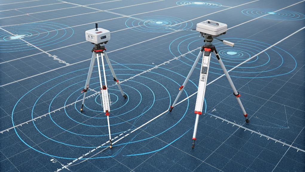
Three core components drive the sophisticated operation of RTK GPS: a fixed base station, a mobile rover unit, and a real-time communication link between them.
Let’s examine how these elements work together to deliver exceptional positioning accuracy.
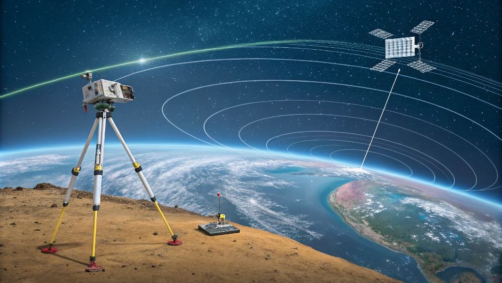
The base station, installed at a known location, continuously monitors GPS signals and calculates its position. When it detects any discrepancies between its known position and GPS-calculated position, it generates correction data that accounts for atmospheric interference and satellite positioning errors.
These real-time corrections are then transmitted to the rover unit through a dedicated communication link.
The rover unit, which can be mounted on vehicles, drones, or handheld devices, receives both the standard GPS signals and the correction data from the base station. By processing this combined information, it achieves centimeter-level accuracy in positioning data.
We’ll find this system updating positions every millisecond, making it ideal for precise navigation and surveying tasks.
The process works most effectively when there’s a clear line of sight between the base station and rover, typically maintaining peak performance within a 20km radius.
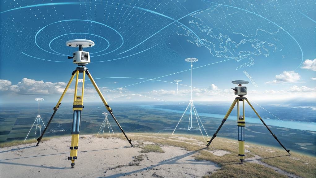
Types of RTK Signals
Building upon the base station and rover setup, multiple signal types work together to achieve RTK’s remarkable precision.
We’ll examine how RTK signals combine carrier phase and code measurements, with the carrier phase providing the high-precision data needed for accurate positioning. The system leverages multi-frequency signals across different wavelengths to compensate for atmospheric interference and enhance reliability.
Let’s explore the three primary components that make RTK technology so effective:
- Carrier phase signals operating on multiple frequencies (L1, L2, and L5), which provide the core measurements for precise positioning
- Differential corrections transmitted from base stations to rovers through various communication channels, including radio and cellular networks
- Multiple GNSS constellations’ signals that work together to strengthen positioning accuracy and reliability
The correction data flows continuously between base station and rover using specialized protocols like NTRIP, ensuring real-time updates.
By integrating signals from GPS, GLONASS, Galileo, and BeiDou constellations, we’re able to achieve robust positioning even in challenging environments.
This thorough approach to signal processing makes RTK an invaluable tool for precise positioning applications.
Applications of RTK GPS
The remarkable precision of RTK GPS has revolutionized numerous industries, from construction to agriculture. This technology excels in applications that require highly accurate positioning data, making it an invaluable tool across multiple sectors.
We’re seeing real-time kinematic GPS transform the way professionals approach precision-based tasks, particularly in land surveying where accuracy is paramount.
In surveying applications, RTK GPS delivers centimeter-level positioning that’s essential for creating accurate property boundaries, topographic maps, and construction layouts.
We’ve witnessed how this technology enables surveyors to collect data points with unprecedented precision while considerably reducing the time needed for field measurements. The system’s ability to provide real-time corrections makes it particularly valuable when immediate results are needed, such as during construction stakeouts or boundary determinations.
What’s especially remarkable is how RTK GPS has streamlined traditional surveying workflows. Instead of relying solely on conventional optical instruments, surveyors can now complete complex measurements in challenging environments with greater efficiency and reliability.
This advancement has made precise positioning more accessible and cost-effective across the surveying industry.
Setting Up an RTK System
Successful implementation of an RTK system requires careful attention to essential components and their configuration. When we’re setting up our RTK system, we’ll need to establish both a base station and rover unit, ensuring they maintain clear satellite visibility for ideal performance.
The base station’s location is particularly significant, as it must be positioned on stable ground with accurate coordinates verified through GPS or survey data.
Let’s focus on three important steps for proper RTK setup:
- Position the base station in a location with an unobstructed view of the sky, allowing it to receive strong satellite signals and provide accurate corrections to the rover.
- Configure the communication method between base station and rover, choosing between NTRIP for internet-based corrections or RTMC for radio transmission.
- Calibrate all GNSS equipment regularly to maintain consistent accuracy throughout operations.
We’ll need to verify that our data link between the base station and rover remains stable during operation. This connection is essential for transmitting correction data in real-time, allowing the rover to achieve the centimeter-level precision that makes RTK technology so beneficial for surveying and navigation applications.
DIY RTK Base Stations
Through careful planning and component selection, creating your own RTK base station offers a cost-effective way to achieve high-precision positioning.
We’ll need to start with a reliable GNSS receiver, mount it securely, and establish a communication link that can transmit real-time data to our rover units. The success of our DIY RTK base station depends heavily on proper placement and setup.
To guarantee peak performance, we’ll want to position our base station at a known geodetic point where it has a clear line of sight to the sky. This placement is vital as it minimizes signal interference and helps maintain consistent correction data transmission.
We can utilize open-source software like RTKLIB to process and distribute our correction data efficiently. It’s essential that we perform regular maintenance checks and calibrate our equipment before any major surveying work begins.
By following these guidelines, we’ll create a reliable DIY RTK base station that can deliver the precise positioning data needed for various applications, from surveying to precision agriculture.
Challenges and Considerations
Despite its impressive capabilities, RTK GPS technology comes with several key challenges we must address for peak performance.
We’ll need to carefully consider environmental factors and operational requirements to maintain accuracy in real time. When implementing RTK systems, there are several critical factors that can impact their effectiveness.
Let’s examine the main challenges we need to address:
- Signal obstructions and line-of-sight requirements pose significant limitations, as buildings, trees, or terrain can interfere with communication between mobile units and base stations.
- Reliable cellular connectivity is essential, as intermittent data connections can compromise the real-time correction capabilities that make RTK systems effective.
- Environmental interference, including multipath signals and atmospheric conditions, can affect positioning accuracy and require careful site selection.
The higher costs associated with RTK systems represent another significant consideration, with equipment ranging from R23,000 to over R200,000.
This investment, while substantial, must be weighed against the precision benefits these systems offer.
To guarantee peak performance, we’ll need to implement continuous monitoring protocols and maintain robust network connections throughout operations.
Futher Reading
For readers keen to deepen their understanding of RTK GPS technology, we’ve compiled a selection of valuable resources covering both theoretical foundations and practical applications.
We recommend starting with Ahmed El-Rabbany’s “Introduction to GPS,” which provides a solid foundation in GPS fundamentals before exploring real-time kinematic concepts.
Those interested in accurate positioning applications will find Conker’s “The Art of Navigation” particularly useful, as it details various RTK system implementations across different industries.
For a practical approach to RTK GPS technology, SparkFun Learn’s guide offers step-by-step instructions on setting up and operating your own RTK system.
We also suggest exploring academic research, particularly Lee and Ge’s work on RTK performance in challenging environments, which provides valuable insights into the technology’s limitations and capabilities.
For those focused on specific applications of RTK in surveying, Lao-Sheng Lin’s comparative study between RTK GPS and Total Station systems offers detailed technical analysis.
These resources collectively provide a thorough understanding of real-time kinematic positioning and its expanding role in modern navigation and surveying applications.
Frequently Asked Questions
What Is Real-Time Kinematic RTK and How Does It Work?
We use RTK to enhance GPS accuracy through a base station that sends correction data to a mobile rover. It’s a system that achieves centimeter-level precision by comparing carrier-phase measurements between stations.
How Does GPS Use Kinematics?
We use GPS kinematics to track movement and position by measuring satellite signals over time. We’re calculating how objects change location, speed, and direction while applying carrier wave measurements for precise positioning.
What Is the Principle of RTK?
Quick as lightning, we’ll tell you that RTK’s principle compares signals between a fixed base station and moving rover, using carrier phase measurements to nail down positions with centimeter-level accuracy in real time.
How Does Real Time GNSS Work?
We use signals from multiple satellites and a base station that sends correction data to our rover. This lets us calculate our exact position in real-time by comparing and adjusting for atmospheric errors.
Conclusion
Like the days when early sailors used sextants to navigate vast oceans, we’ve come a long way in positioning technology. RTK GPS represents a quantum leap forward in precision navigation, offering centimeter-level accuracy that’s transforming industries from construction to agriculture. We’ve explored how this technology works, its applications, and setup requirements. As RTK continues to evolve, we’ll see even more innovative uses emerge in autonomous systems and precision operations.