
Surveying is a scientific field that determines precise positions of points and features on Earth’s surface through systematic measurements. This discipline combines mathematical principles with practical techniques to create accurate maps, plans, and documentation. Surveyors use specialized equipment like GPS receivers and total stations to measure distances, angles, and elevations for various purposes, including property boundaries and construction projects. The field encompasses multiple specialties, from geodetic surveying that considers Earth’s curvature to engineering surveying for construction projects. Understanding this essential discipline reveals its critical role in modern construction, mapping, and property management.
What is surverying?
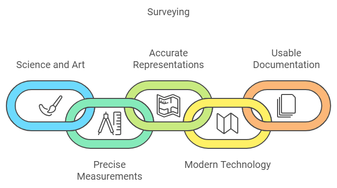
Surveying is the science and art of determining the relative positions of points on, above, or beneath the Earth’s surface through precise measurements. This essential field combines mathematical principles with practical techniques to create accurate representations of land areas, including their physical and cultural features.
Surveyors measure distances, angles, and elevations to establish the exact locations of natural and human-made objects. The primary goal of surveying is to produce usable documentation, such as maps and plans, that accurately represent measured areas.
These documents show the lengths and directions of boundary lines, surface contours, and the relative positions of important features. Surveyors achieve this by using various instruments and methods, including traditional tools like theodolites and modern technology such as total stations and GPS receivers. Economic viability of major projects is often determined through comprehensive survey work.
Through careful measurement and calculation, surveying provides the foundation for numerous applications. It helps determine land boundaries, supports civil engineering projects, and guarantees construction accuracy.
The field continues to evolve with new technology, but its fundamental purpose remains unchanged: to provide precise spatial information for human activities and development.
Types of Surveying
Surveying encompasses several distinct types, with three primary categories being Geodetic, Engineering, and Topographic surveying.
Geodetic surveying considers Earth’s curvature for large-scale measurements, while Engineering surveying focuses on construction projects and infrastructure development. Remote sensing technology provides advanced data collection capabilities for large areas without direct measurement.
Topographic surveying creates detailed maps showing natural and artificial features of land surfaces, including elevations, contours, and physical features.
Geodetic Surveying
One of the most extensive forms of measurement science, geodetic surveying encompasses the precise mapping and measurement of the Earth’s surface while accounting for its spheroidal shape, size, and curvature. This specialized field utilizes advanced equipment such as GPS receivers, total stations, and theodolites to establish accurate reference points for other surveys. High precision is fundamental to geodetic operations.
Geodetic surveying comprises several distinct types, each serving specific purposes. Control surveys create networks of reference points, while topographic surveys map surface features and elevations. Cadastral surveys focus on property boundaries, and hydrographic surveys measure underwater features. Astronomical surveys determine absolute locations using celestial observations.
The field employs various technical methods, including triangulation to determine station positions and geodetic leveling to measure relative heights. Modern technology has enhanced these traditional approaches through automatic monitoring systems and laser scanning techniques.
These tools enable surveyors to collect precise data for multiple applications, from construction and mining to environmental management and structural monitoring. The accuracy of geodetic surveying makes it essential for large-scale projects where the Earth’s curvature greatly impacts measurements.
Engineering Surveying
At the heart of infrastructure development lies engineering surveying, a specialized discipline that provides critical measurements and data for designing, planning, and executing civil engineering projects. This branch of surveying focuses on collecting precise information about land features and determining relative positions of points to support construction and development initiatives.
Engineering surveying employs various methods to achieve its objectives. These include reconnaissance surveys for initial feasibility studies, preliminary surveys for cost estimation, and location surveys for groundwork implementation. Plane surveying is primarily used when working with smaller areas where Earth’s curvature can be neglected.
Traverse surveying helps create plans by measuring angles between connected straight lines, while leveling surveys determine vertical distances between points.
The applications of engineering surveying are extensive, ranging from designing transportation infrastructure to planning water management systems. Surveyors use multiple instruments and techniques to gather accurate data, including traditional chain surveying, theodolite measurements, and modern GPS technology.
These tools enable precise measurements for construction projects, property boundary establishment, and site planning activities. The collected data supports feasibility studies, aids in cost estimation, and guarantees accurate positioning during project execution.
Topographic Surveying
Topographic surveying stands as a specialized discipline that captures the three-dimensional characteristics of terrain and built environments. This form of surveying creates detailed maps that document both natural and constructed features, providing vital data about elevation changes, slopes, and landscape configurations. Surveyors collect this information through various methods, including traditional ground-based techniques and modern satellite technology. Reference points are typically aligned to an Ordnance Survey datum to ensure standardized and reliable measurements.
The process involves several key components, including the establishment of boundaries, recording of significant features, and collection of elevation data points. These points are then used to create contour lines, which represent areas of equal elevation and help visualize the terrain’s topography.
Surveyors employ a range of equipment to gather this data, from traditional tools like total stations and theodolites to advanced technology such as GPS systems and drones.
Multiple surveying techniques are utilized depending on the project’s requirements. These include geodetic surveys for large-scale mapping, plane surveys for local projects, and airborne surveys for extensive coverage of extensive areas.
The collected data serves various purposes, from construction planning to environmental assessment, making topographic surveys vital for informed decision-making in development projects.
Same word, different meanings

It is important to understand that the term “surveying” carries different meanings across various professional fields and contexts.
While statistical or research surveys collect data through questionnaires and interviews, land surveying involves precise physical measurements of property boundaries and terrain features.
Similarly, building surveying focuses on the condition and maintenance of structures, quantity surveying deals with construction costs, and hydrographic surveying specifically examines underwater terrain and marine features. Engineering surveys provide data for construction projects through preliminary site analysis to support detailed planning and cost estimation.
Surveying vs statistical or research surveys
Language precision becomes essential when discussing surveying, as the term encompasses two distinct professional disciplines.
The history of engineering surveying dates back to ancient Egypt where rope stretchers helped establish boundaries after floods.
Traditional surveying in civil engineering and geography involves determining positions and measurements on Earth’s surface, using specialized equipment like total stations and GPS receivers. In contrast, statistical or research surveys focus on gathering data about populations through questionnaires, interviews, and observations to understand behaviors and trends.
While both fields require precision and methodology, they differ considerably in their applications and tools:
- Engineering surveying measures physical features and spatial relationships, supporting construction projects and mapping.
- Research surveys collect information about people’s opinions, behaviors, or characteristics through systematic questioning.
- Statistical surveys employ sampling techniques and data analysis to draw conclusions about larger populations.
These disciplines share the common thread of systematic data collection but serve different purposes.
Engineering surveying produces tangible measurements for physical projects and mapping, while research surveys generate data for understanding social phenomena, market trends, or public opinion.
Both fields require specific expertise and methodologies to guarantee accurate results within their respective domains.
Cadastral (Land) Surveying vs. Building Surveying
The term “surveying” encompasses two distinct professional disciplines within the built environment: cadastral (land) surveying and building surveying. While both involve detailed measurements and assessments, they serve different purposes and require specific expertise.
Cadastral surveying focuses on measuring and mapping land parcels, establishing property boundaries, and creating accurate land ownership records. This discipline employs advanced technologies such as GPS, GIS, and remote sensing, alongside traditional methods like theodolite surveys. These surveys are essential for legal land transactions and property documentation.
Surveyors use specialized equipment including total stations and RTK positioning systems to guarantee precise measurements for legal documentation and urban planning purposes.
Building surveying, on the other hand, concentrates on evaluating existing structures and buildings. These professionals assess property conditions, structural integrity, and potential defects using diagnostic tools like thermal cameras and moisture meters.
Their work is essential for property transactions, insurance assessments, and renovation planning. Building surveyors conduct visual inspections, analyze building plans, and provide detailed reports with recommendations for maintenance and improvements.
This specialized field helps property owners, buyers, and insurers make informed decisions about building management and investments.
Land Surveying vs. Quantity Surveying
While both cadastral and building surveying represent distinct specialties within property assessment, another significant distinction exists between land surveying and quantity surveying. Professional certification and licensure are mandatory requirements for practicing land surveyors.
Land surveying focuses on determining precise locations, boundaries, and topographical features of properties using specialized equipment and mathematical calculations. In contrast, quantity surveying deals with the financial and contractual aspects of construction projects, including cost estimation and budget management.
The key differences between these disciplines are reflected in their core functions and required expertise.
Land surveyors work primarily outdoors, using tools like GPS systems and total stations to measure and map physical properties. Quantity surveyors typically work from offices, analyzing costs and managing construction project finances.
- Land surveyors require expertise in geometry, GPS technology, and property law, while quantity surveyors need strong financial and contractual knowledge.
- Land surveying produces physical property measurements and legal documentation, whereas quantity surveying generates cost estimates and financial reports.
- Land surveyors settle boundary disputes and create maps, while quantity surveyors manage construction budgets and perform cost-benefit analyses.
These distinct roles serve different yet essential purposes in property development and construction industries.
Hydrographic Surveying vs. Marine Surveying
Modern nautical professionals often encounter confusion between hydrographic surveying and marine surveying, despite both terms relating to water-based evaluation activities. The key distinction lies in their primary focus and application.
Hydrographic surveying concentrates on mapping and measuring underwater features and environments. It employs advanced technologies such as sonar systems, GPS, multi-beam echo sounders, and LiDAR to create detailed maps of underwater topography. This type of surveying is essential for maritime navigation, marine construction, dredging operations, and planning subsea cable routes. Environmental monitoring through hydrographic surveys helps detect and track human-caused damage in marine ecosystems.
In contrast, marine surveying primarily involves the inspection and evaluation of marine vessels and their cargo. Marine surveyors focus on gauging ship conditions, ensuring compliance with safety regulations, and evaluating cargo integrity. While they may use some specialized equipment, their work typically involves more traditional inspection methods and documentation procedures.
The tools and methodologies also differ considerably. Hydrographic surveys require sophisticated data collection and processing systems, often utilizing survey vessels and remote sensing techniques.
Marine surveying relies more on visual inspections and conventional evaluation tools, though there may be some overlap when examining underwater vessel components.
Surveying is an important discipline that underpins construction, property management, and infrastructure development. Its diverse specialties, from geodetic to engineering and hydrographic surveying, showcase its adaptability and importance in creating accurate, actionable data for various industries.
Need precise survey data for your project? Contact us today to request a quote and ensure your project’s success with our reliable and professional surveying services.