Land Surveying
Achieve Accuracy and Confidence with Professional Land Surveys

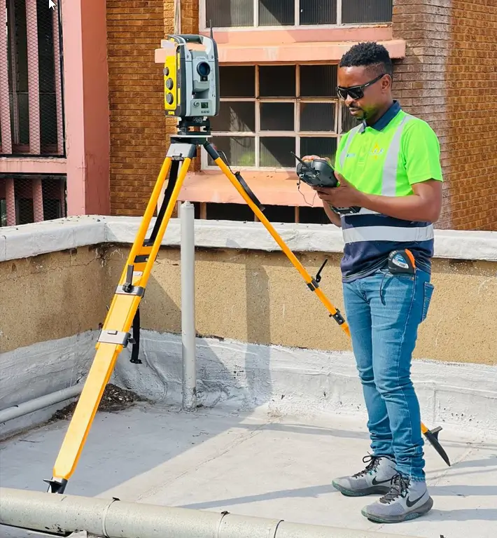
Land Surveying Done Right
Planning a project, subdivision or site layout starts with clear and accurate land survey data.
You need boundaries marked correctly, levels measured with precision and reports you can trust. Poor or unclear land surveys lead to delays, disputes and costly mistakes.
At PVR Engineering Surveyors, we provide accurate and dependable land surveys for property owners, developers, engineers, architects and construction teams.
Our work gives you the clarity you need to design, build and plan with confidence.
When accuracy matters most, clients choose PVR. We apply strict standards, modern equipment and a hands-on approach to deliver clear, reliable land survey data.
Specialised Land Surveying Services
We provide a full range of land survey services, including:
-
Topographical surveys
-
Boundary surveys
-
Site layout and pegging
-
Subdivision surveys
-
As-built surveys
-
Contour surveys
-
Sectional title surveys
-
Servitude surveys
-
Wayleave surveys
-
Property development surveys
-
Engineering layout for roads, drainage and building lines
-
Realignment surveys
-
Drone-based mapping and 3D site capture (where required)
We produce clear reports, CAD files, layouts and maps that help you progress your project with confidence.
How the Land Surveying Process Works
Our land survey process is built for accuracy and clarity.
We take time to understand your site, confirm your needs and deliver data you can rely on.
Whether you are planning new construction, buying land, resolving boundary issues or working on municipal approvals, our team makes the process simple, clear and stress-free.
Our Project Precision Process
How we approach every project to keep data accurate, teams aligned, and work moving.
Assess
We understand your surveying needs and challenges
Execute
We use our advanced technology and experienced professionals to conduct thorough surveys.
Deliver
You get precise survey data that helps your project succeed and be efficient.
Here's Why You Should Trust PVR Engineering Surveyors
There are many surveyors who can conduct surveys, but there’s only one PVR Engineering Surveyors. Clients choose us because:
- We guarantee precision and quality in our work
- We bring honesty & transparency to surveying
- We’re experienced in handling complex site challenges
- We only employ qualified professionals
- We use modern technology for precise and efficient surveys
- We provide detailed reports with clear insights and useful data
FAQs
How much does it cost to do a survey?
The cost of a land survey varies based on the type and complexity of the survey needed. Contact us for a tailored quote.
How much does land surveying cost near me?
Our prices are competitive and reflect the quality and accuracy of our services. Reach out to us for specific pricing in your area.
What should I think about if I hire a land surveyor near me?
Consider the surveyor’s experience, qualifications, technology used, and client testimonials to ensure you choose a reliable professional.
How do I know if a surveyor is qualified?
Verify their certifications, memberships in professional organisations, and client reviews. PVR Engineering Surveyors meets all these criteria.
How long does a surveyor take?
The time required depends on the survey type and project size. We provide estimates based on your specific needs.
What types of surveys do you provide?
We offer a wide range of surveys including boundary, topographic, servitude, township establishment, setting out, road and rail construction, construction, as-built, and subdivision and consolidation surveys.
Ready to Get Started?
Partner with PVR Engineering Surveyors for precise and reliable land survey services.
Let our expert team and advanced tools give you accurate data for better planning.